Waratah Part 2 - 1917-1918
Following the street realignment and sale of Waratah, three sets of residential flat buildings are built on the Waratah estate. They remain until they are demolished for the tunnel.
1. Plans are lodged and approved on 4 July 1917 to add two storeys to Waratah and turn it into flats (all plans are from the City of Sydney Archive):

2. Also in 1917, plans are lodged for these three buildings at the rear of the above building on the southern boundary, ie facing Woolcott Street, each comprising two flats.

A revised plan for the entries of these buildings is lodged,
and approved on 3 September 1918:

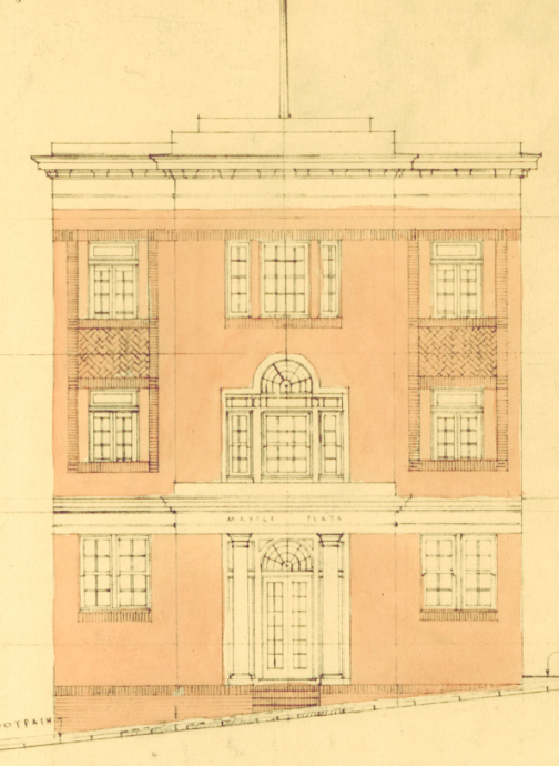
3. Plans for a large block on the north western boundary are approved on 14 November 1918. It stands where Ward Avenue is now. The northern elevation to Bayswater Road looked like this in the plans:


Postcard
c1930s. From Stations of the X Facebook page.

A view of this elevation taken on 7 July 1960

Photo by Peter Sage, found on lindsaybridge’s Flickr page https://www.flickr.com/photos/intervene/22021005432/

Comments
Post a Comment